
Mount Assiniboine Provincial Park Hiking Resource & Photographer
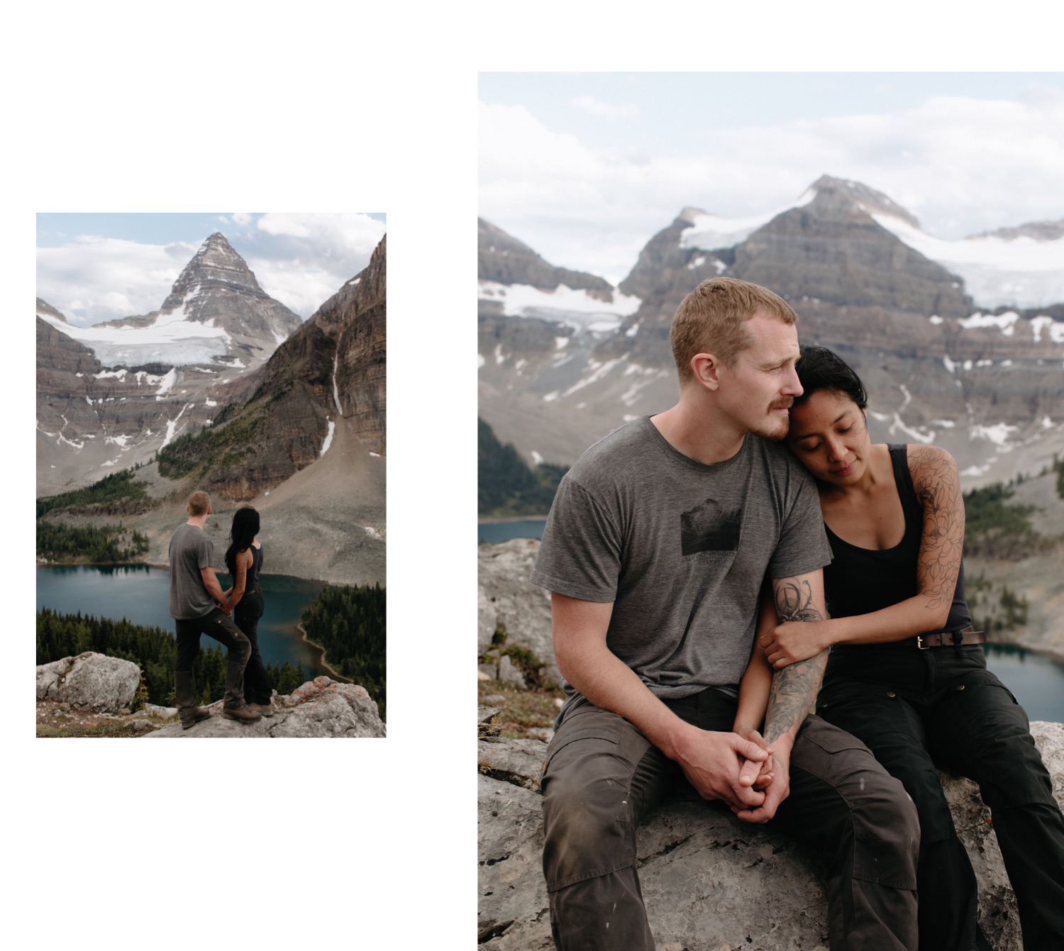
I would like to take a moment and thank the particular disaster of a year that was 2020 for making this all possible. Mount Assiniboine Provincial Park has been a dream backpacking trip for years. Yet, every summer my schedule around weddings and elopements simply did not allow for me to take the time off and away from my computer to make a proper hiking camping trip of it. Then March 2020 hit, my summer wedding and elopement photography plans evaporated, as did all the reservations for Mount Assiniboine Provincial Park, and so began the dreamchild that was trekking to the Matterhorn of the Rockies with my dear friends Camille, Justin, and my husband Sam.
I hope this write-up acts as a personal guide of sorts. A humorous collection of practical recommendations, of stories and anecdotes, from a motley crew who finally got to experience one of the most sought-after trails that the Canadian Rockies has to offer.
What Route to Hike to Assiniboine
You have several different options for how to access Mount Assiniboine Provincial Park.
Helicopter to Assiniboine
The easiest is to fly by helicopter from either Mount Shark Helipad or Canmore Heliport (Assiniboine Lodge guests are prioritized for the Canmore heliport flight). You can find all the information you need about this on the Assiniboine Lodge website, where bookings are made regardless of whether you are staying at the lodge or not. This may be a good option if you are tight on time, as the hike in and out from Mount Assiniboine Provincial Park takes at least half a day to complete. In previous years hikers were able to have their pack transported however on account of COVID restrictions, this was not an option for 2020 and this has been extended through to 2021. You could perhaps consider hiking one way and taking the helicopter the other if you want both experiences. As temporarily very unemployed people, who needed to save money as well as motivation to hike through our empty summer, we opted to hike both directions.
Hiking Routes to Assiniboine
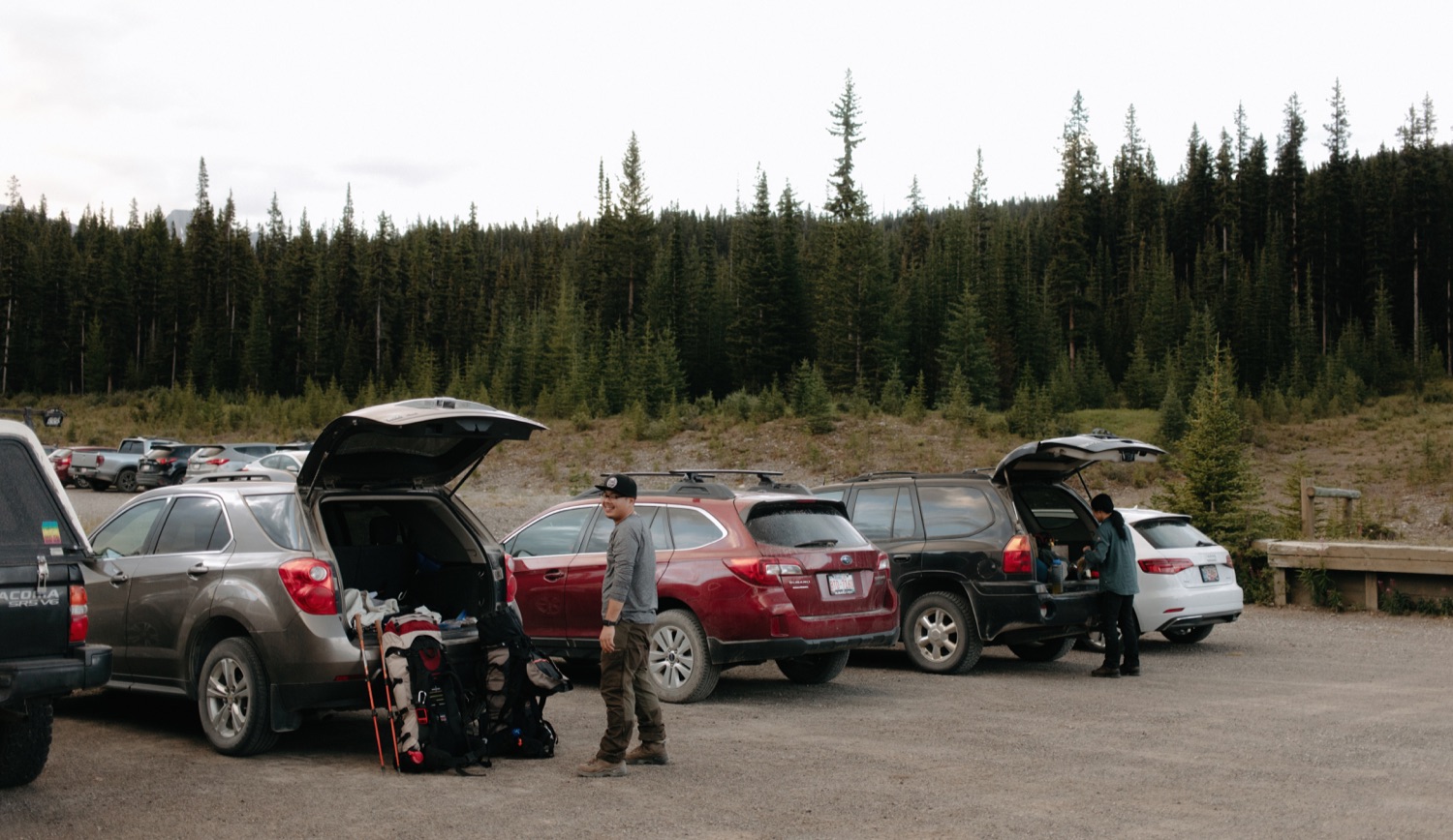
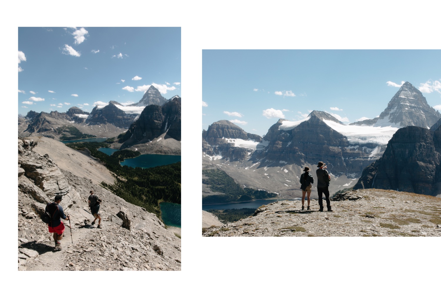
As we were planning to go to Mount Assiniboine Provincial Park there were several nights of madly googling and pouring over books to sort out how long the hike really was, which route best suited our needs, and the added complexity of how COVID-19 changed all of that. I’ll briefly go over findings but want to give due credit to the Don’t Waste Your Time in the Canadian Rockies: The Opinionated Hiking Guide by Kathy and Craig Copeland for once again being our guiding beacon. There are three main trails to Mount Assiniboine Provincial Park, two accessible from Mount Shark Trailhead, one from Sunshine Village, all outlined on the Assiniboine Lodge website. Please note the distances and elevation listed below are from Kathy and Craig’s book – the distances on Assiniboine Lodge’s website are listed as longer.
Assiniboine from Sunshine Village via Citadel Pass
Disclaimer: We did not take this route on account of the shuttle being closed at Sunshine Village, which would have added 5.7km and 525m of elevation to an already long day. In a non-COVID year, this would have been our route
Distance one way: 28km to Lake Magog, 22.2km to Og Lake Campground
Elevation gain: 433m
Time: 8-10h
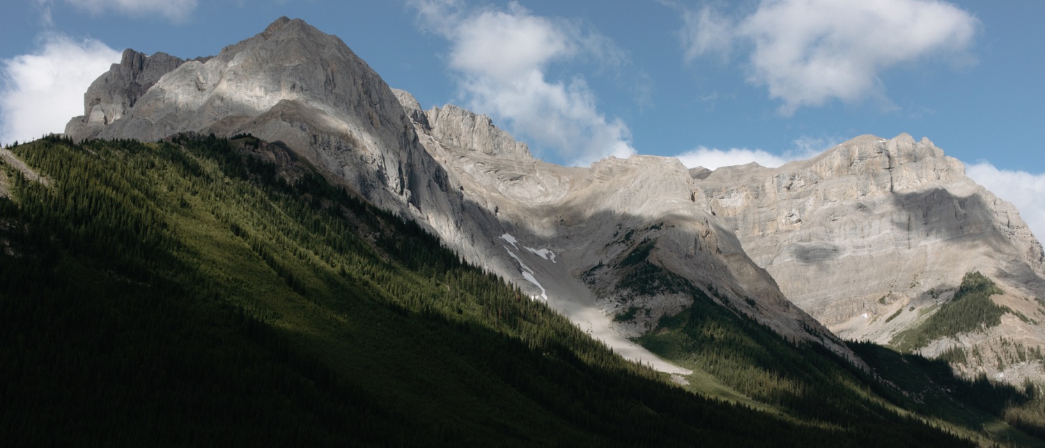
From all my reading this is the preferred route to take to Lake Magog, with glorious views from Citadel Pass, Mount Assiniboine a beacon of where you are heading for the vast majority of the hike (compared to the 13km forest walk along the Bryant Creek routes). However, you’ll have to arrange for one car to be left at Sunshine Village and another at Mount Shark (or arrange a shuttle between the two to retrieve your car from a private company such as White Mountain Adventures). You have the option of doing the full hike to Lake Magog, or stop at Og Lake Campground for one night.
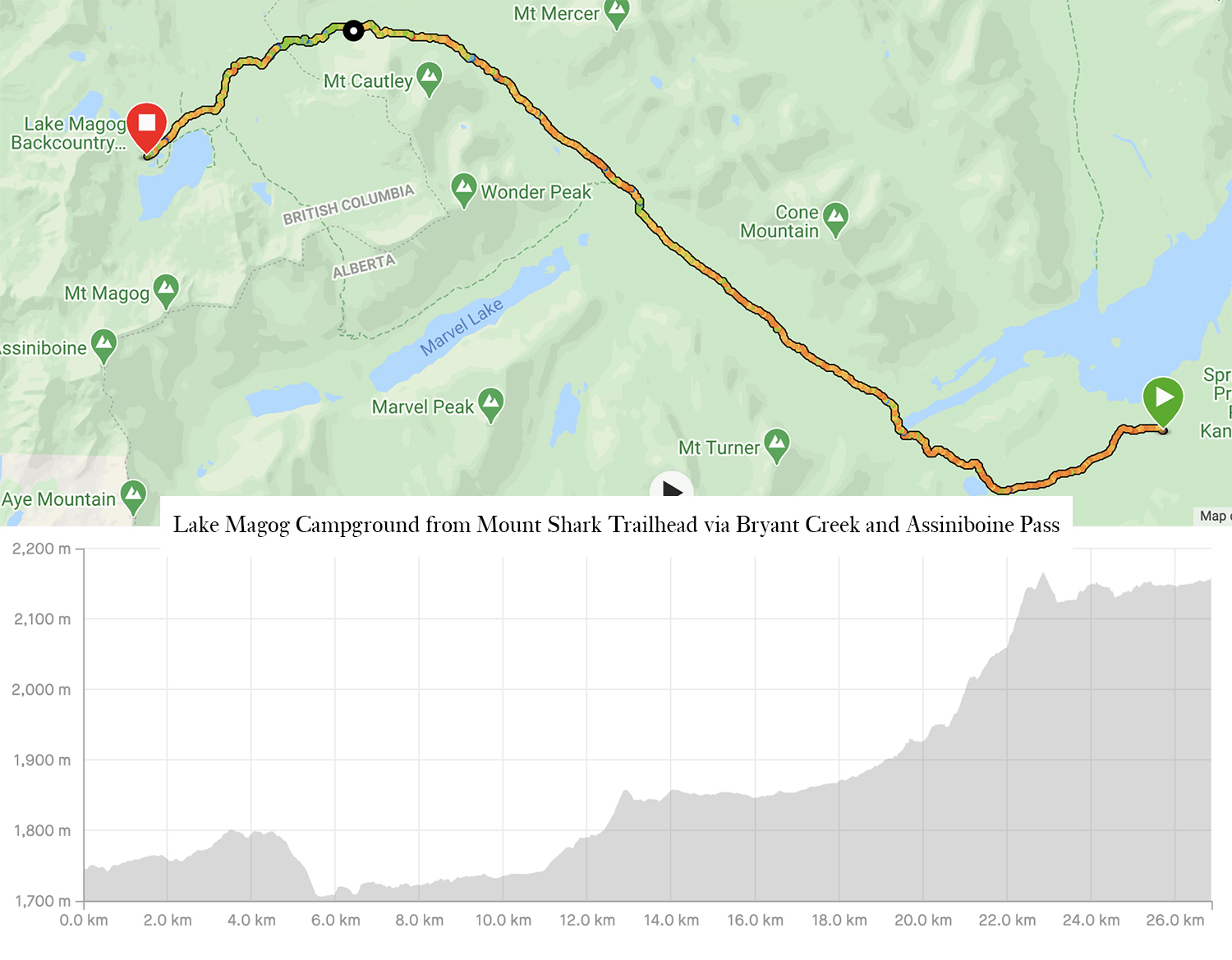
Lake Magog Campground from Mount Shark Trailhead via Bryant Creek and Assiniboine Pass
Distance one way: 24.6km (our recorded distance was 26.9km)
Elevation gain: 495m (our recorded elevation gain was 668m and elevation loss of 223m)
Time: 6-8hours (We took 8h with a total moving time of 6h40m)
The quickest and easiest route, and while widely reviewed as a bit of a slog and rather underwhelming, I can wholeheartedly say it was enjoyable nonetheless. So you are aware, there are two variations of this hike (I know, so enthralling, more choices) at a rather confusing junction at 17.3km you may take the horse trail route (which we took), and the hikers’ bypass trail. The hikers’ bypass trail adds 1km to the total distance, is more scenic and the elevation gain is more gradual, however, it is closed from August 1-September 30 to decrease grizzly and human encounters. We did not find the junction clearly stated the hikers’ bypass trail was closed to use when we hiked through, so it is vital you know this information beforehand if you are hiking between August 1 and September 30.
Other than the distance, we all found this route quite easy. It was relatively flat save for 100m of elevation gain between 11km and 13km, and of course as you ascend Assiniboine Pass starting at approximately 19km and ending at 23km with a grand total of 270m of elevation gain. So while the elevation gain may seem a bit intimidating, I promise you can do it.
We found the route very easy to follow save for that one pesky junction where you can either take the horse trail or hiker’s bypass. In this situation having The Opinionated Hiking Guide booklet was crucial in not taking the wrong route. In the best wrong circumstance we would have ended up at Allenby campground shortly, in the worse case we would have ventured onto the hiker’s bypass trail. So I’d highly recommend familiarizing yourself with the route to Assiniboine beforehand.
Summary of how this hike goes?
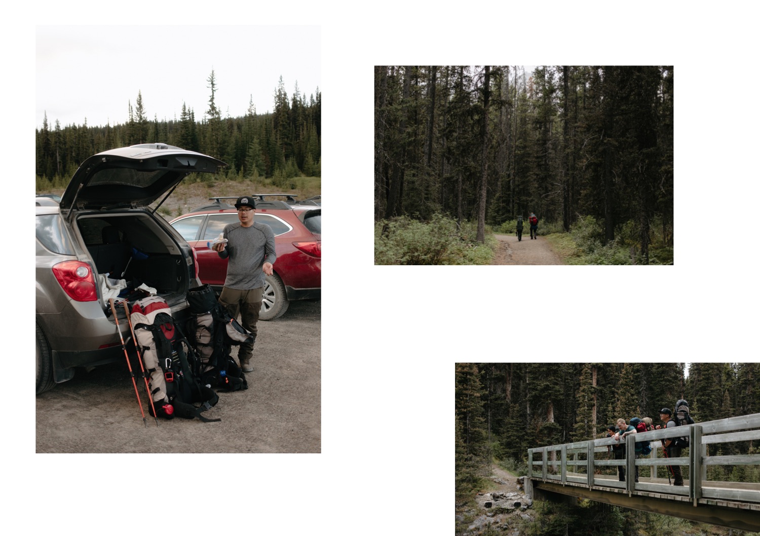
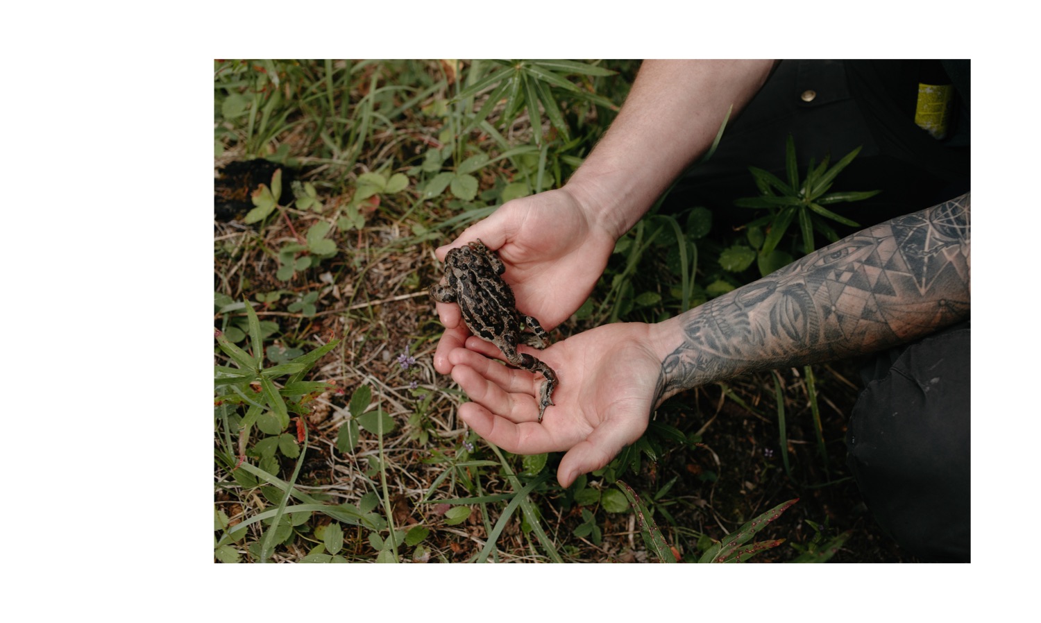
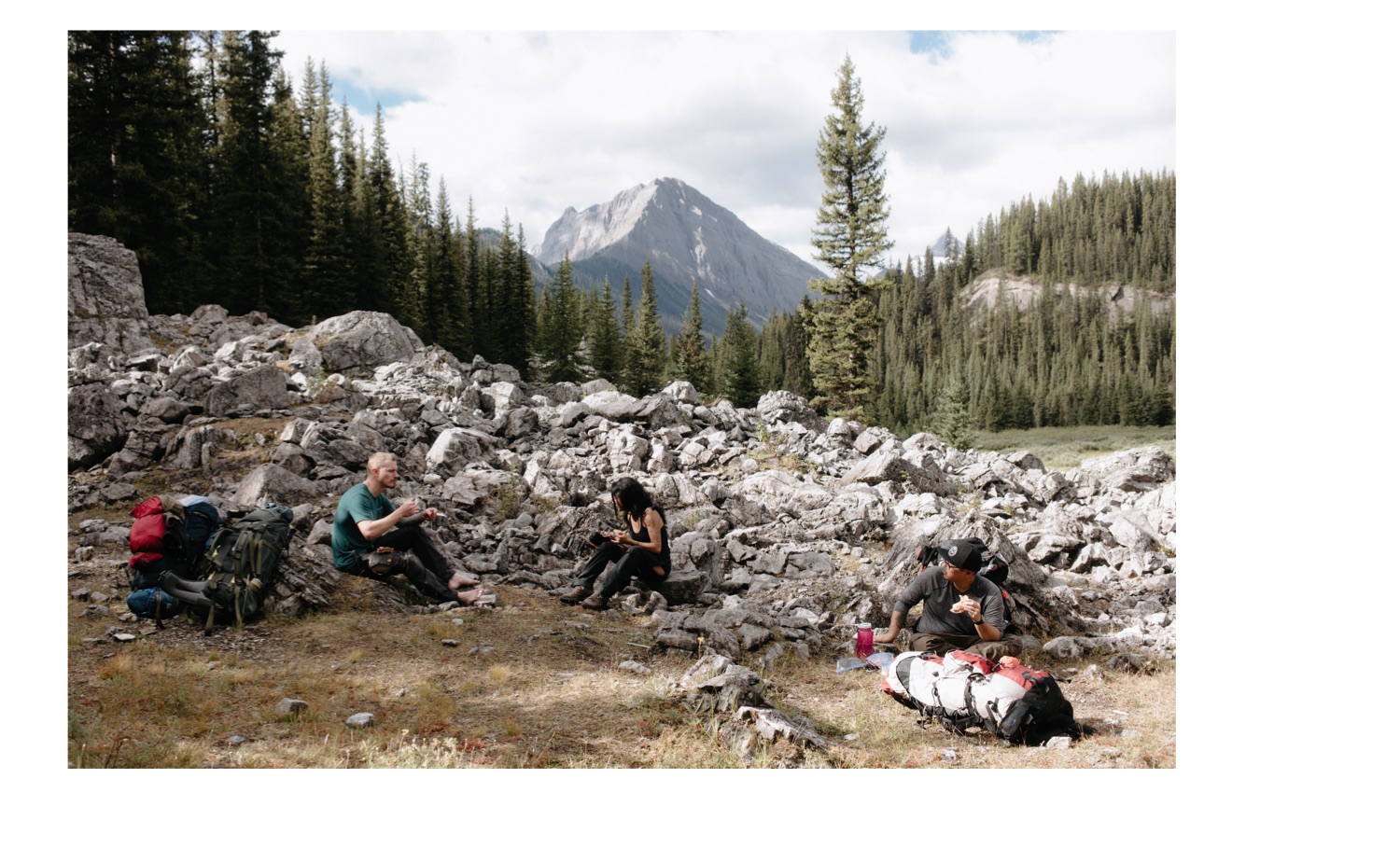
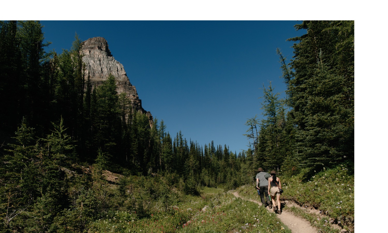
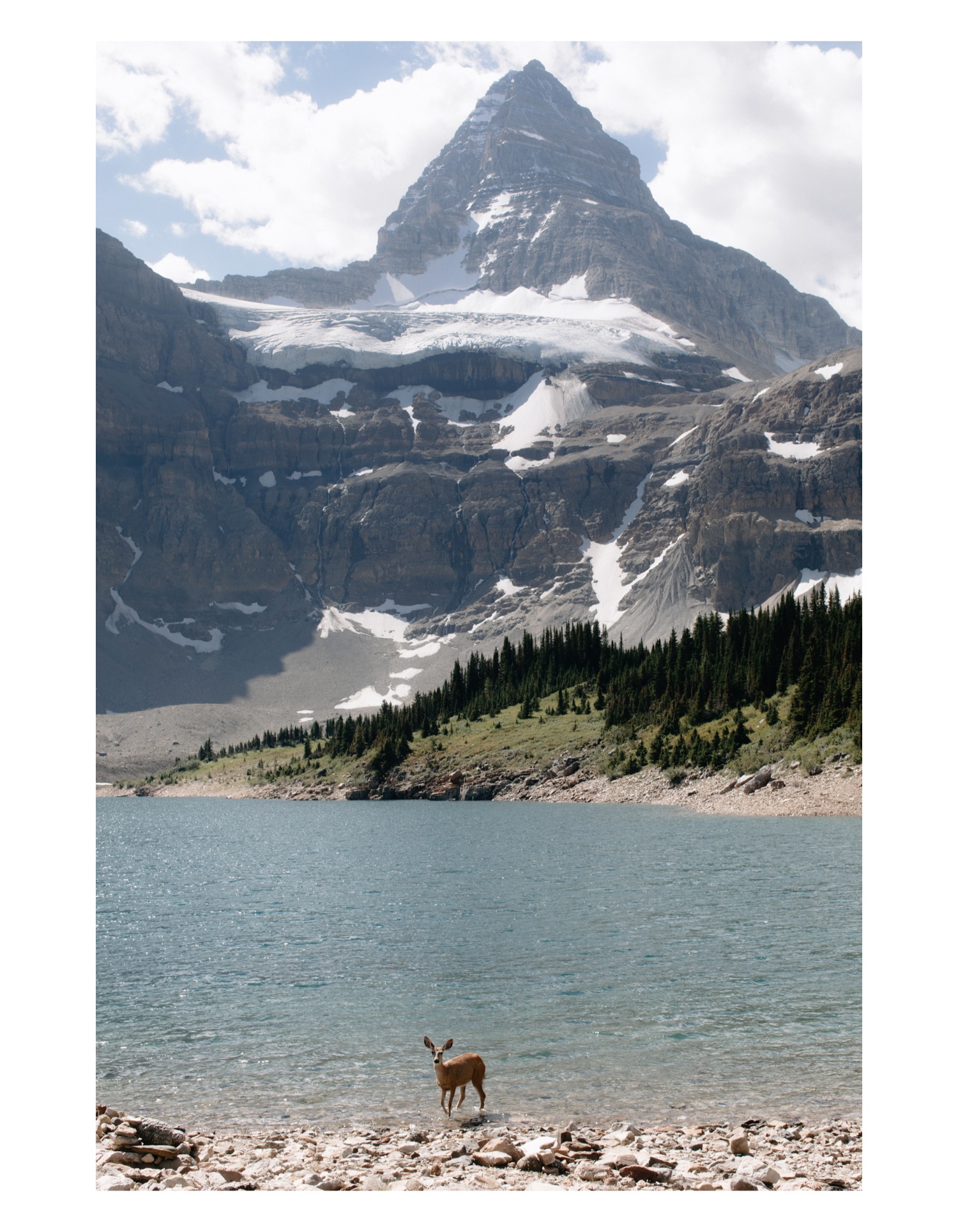
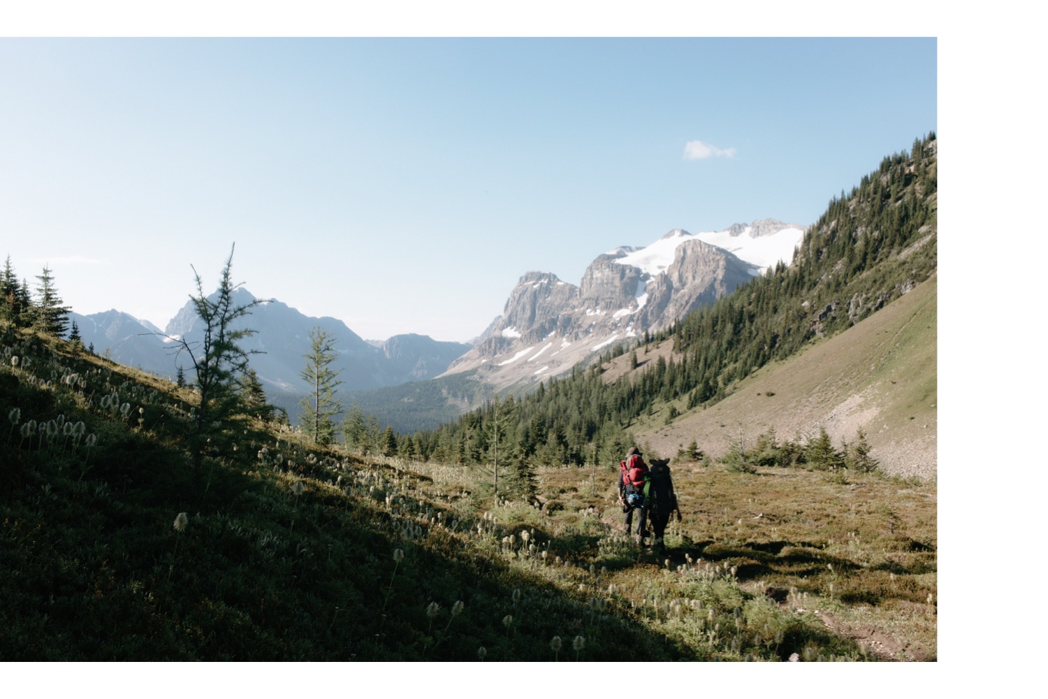
0km-13km, forest walk with the odd little bridge crossing, a whole boatload of spotted frogs, wary deer in the forest, and a rather intimidating sign reminding hikers you are in grizzly territory.
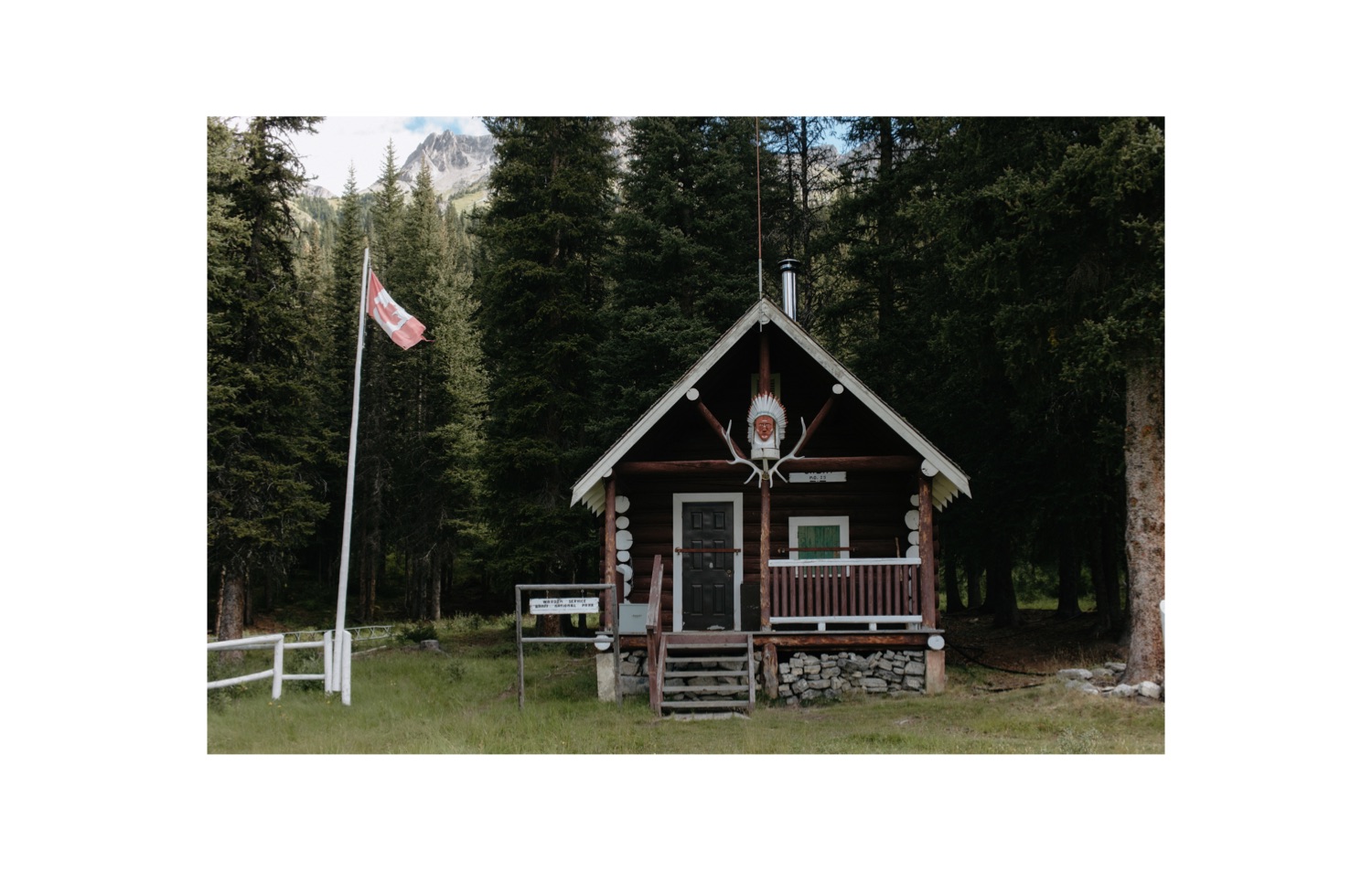
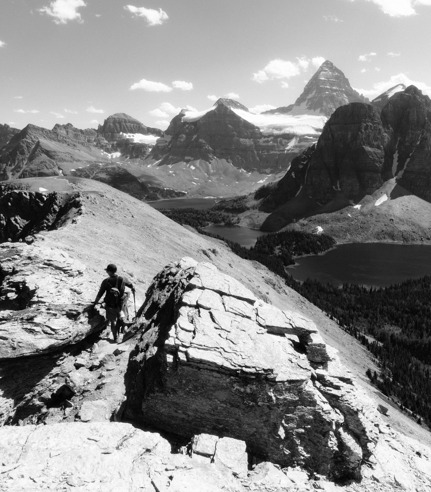
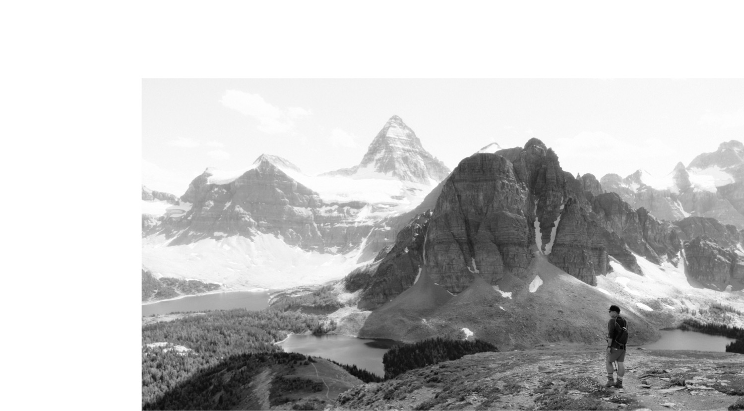
13km-14km, oh my goodness buildings (Bryant Creek Shelter, followed by McBride’s Camp and the Bryant Creek warden camp), old bear poop, oh wow we can actually see mountains, oh shit we have to hike around then over this mountain, oh well.
14km-19km, views for days(!), this looks marshy and I should have brought more bug spray, somewhere in here you have to choose the correct trail to take, make sure you filter and fill up on water before the pass here.
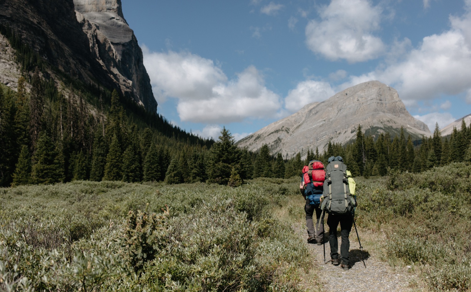
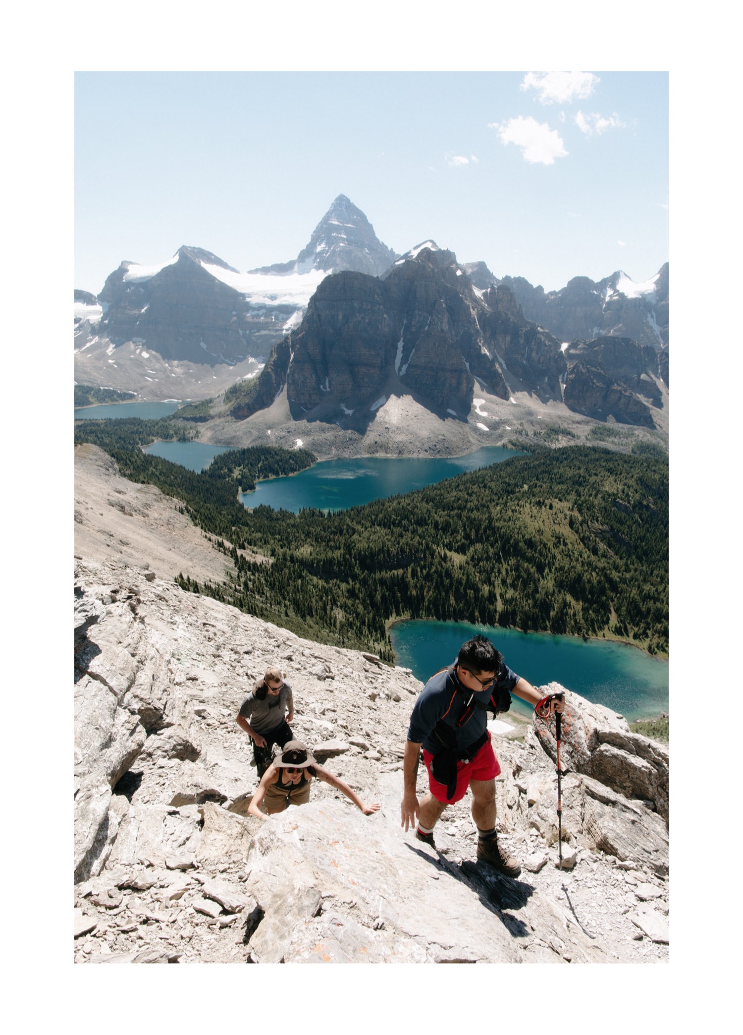
19km-23km, this is mostly switchbacks, paired with some mild bushwhacking through avalanche paths that have moved some foliage onto the trail, it feels like it never ends when you are carrying 40lbs but I can assure you, it’s worth the pain.
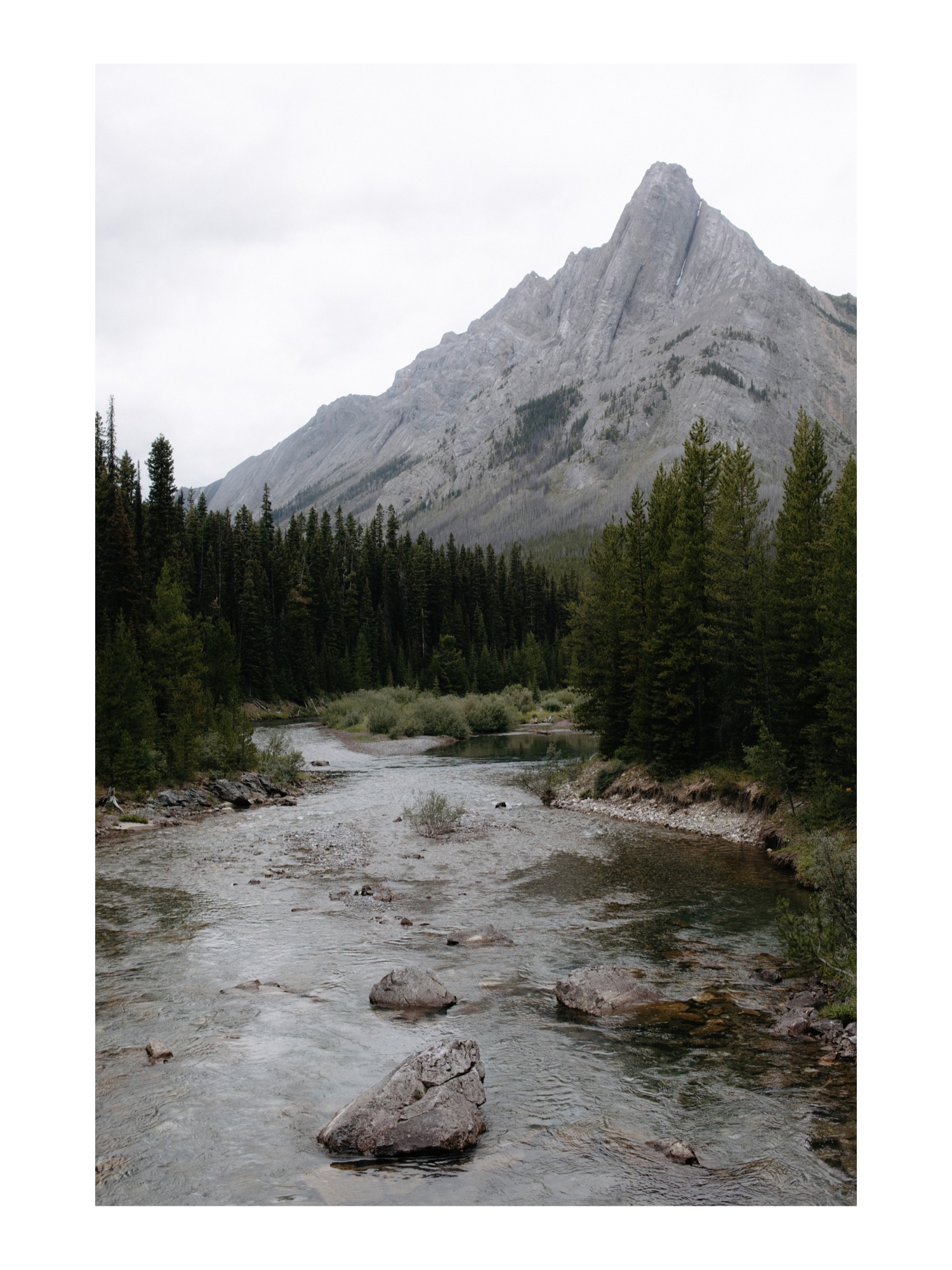
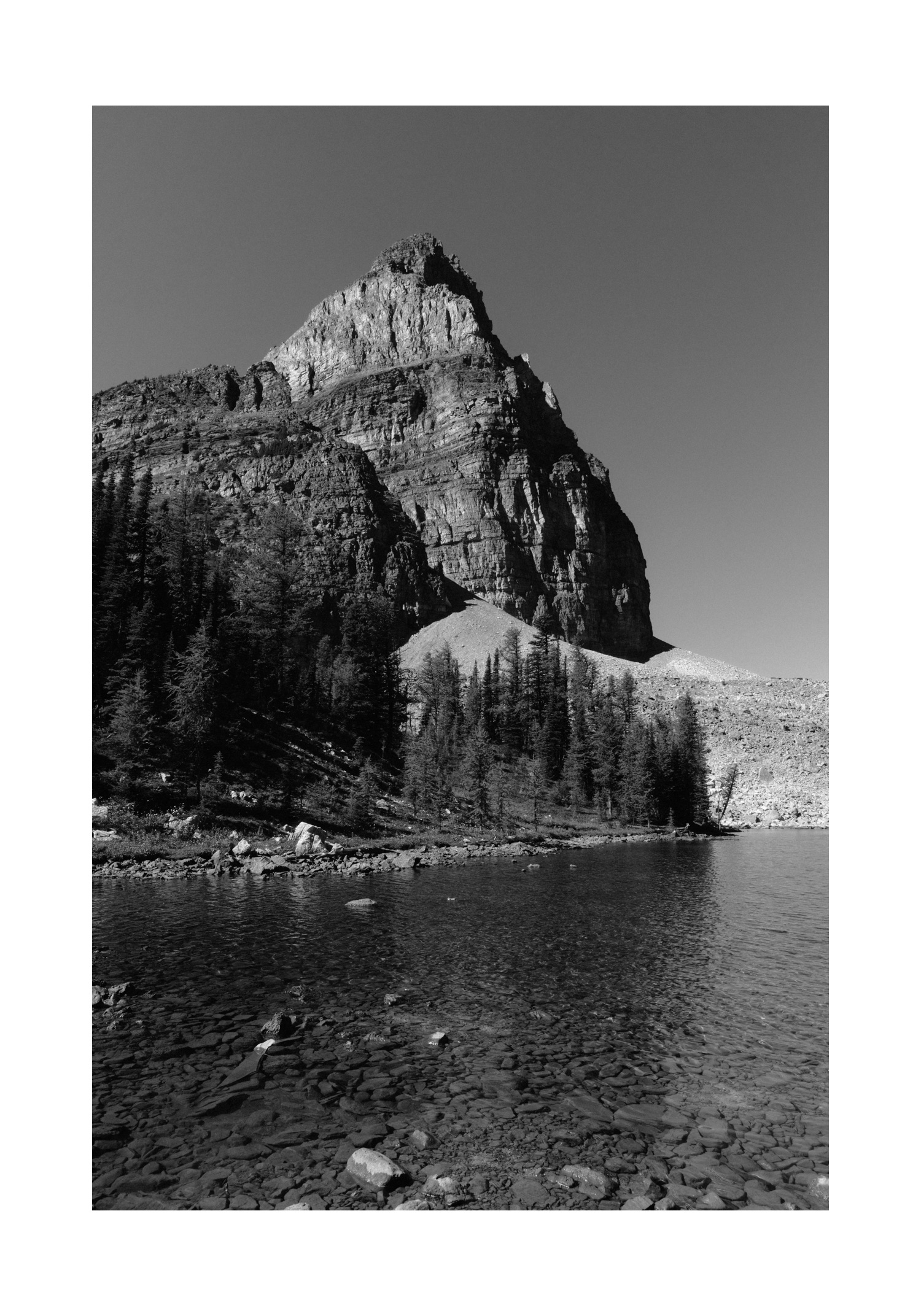
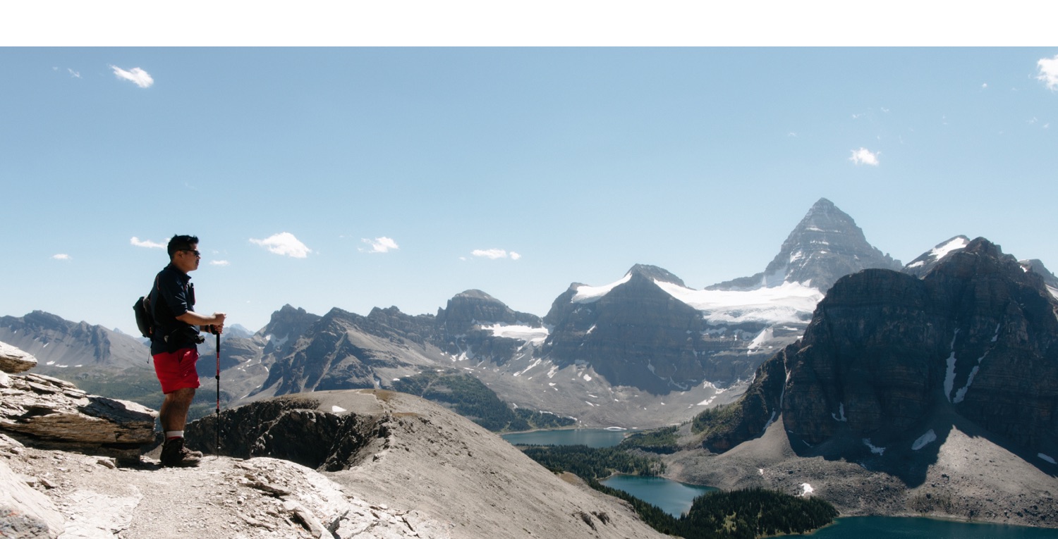
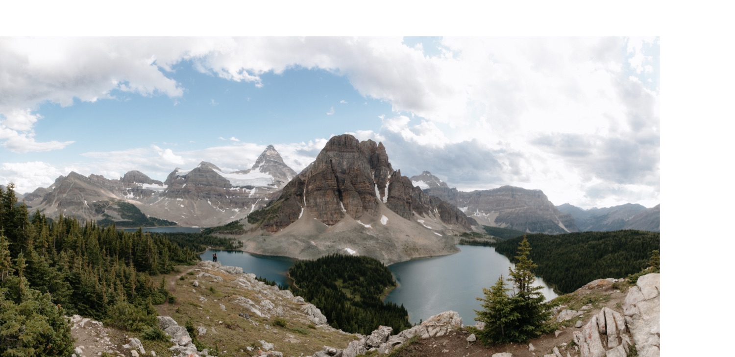
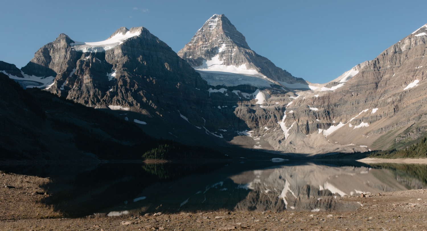
23km-27km, you have reached the top of the pass, Mount Assiniboine is visible, there is a sign stating you are in British Columbia, life is good, there are a ridiculous amount of signs telling you which trail to take to Assiniboine Lodge, the Naiset Huts, or the campground. You did it!
At the end of this post is an elevation gain map as well as the route for reaching Lake Magog Campground from Mount Shark Trailhead via Bryant Creek and Assiniboine Pass. You may also download my GPX file here.
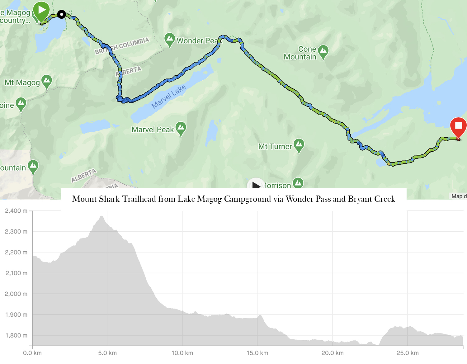
Mount Shark Trailhead from Lake Magog Campground via Wonder Pass and Bryant Creek
Distance one way: 26km (our recorded distance was 28.7km)
Elevation gain: 325m (our recorded elevation gain was 523m and elevation loss of 910m)
Time: 7-9hours (We took 8h with a total moving time of 6h50m)
While the jury is out on the best hike to Mount Assiniboine Provincial Park, depending on your preference for views or time, nearly everyone seems to agree that the best way to leave Mount Assiniboine Provincial Park is through Wonder Pass and joining the Bryant Creek trail. I can attest, it was an absolutely stunning way to end our trip, with nearly all the elevation gain at the beginning, and the most expansive of views while descending towards Marvel Lake.
Truly, this hike was very straightforward. The tidbits I wish I knew beforehand is that the entire northeast stretch alongside Marvel Lake is more exposed than I was expecting – not in terms of danger but just no forest. So on an average temperature day, this would be fine, but we hiked out in 30C+ temperatures and that was hot and long. The second is after you pass Lake Magog and reenter the valley where you connect with the Bryant Creek trail at 13.7km, there is a split in the trail I believe after crossing a bridge – we decided to mix things up and take the trail right since it was new to us. Well, spoilers, it was through brush that had my ‘dear god, there be ticks’ alarms ringing for 1km until it rejoined the trail, so, my advice is to take the trail you recognize. The third is that the worse part of this entire backpacking trip was the 65m of elevation at 23km. On an average hike 65m of elevation gain would be nothing, but after nearly 100km of hiking in several days, with a backpack that I can only assume got heavier as the day went by, so close yet so far from the car, this part was awful. I highly recommend just belting out curse words the whole way up this stretch.
So the quick guide to leaving Mount Assiniboine Provincial Park via Wonder Pass is:
0km-4.5km, beautiful views leaving Mount Assiniboine Provincial Park, Assiniboine Lodge, Naiset Huts, Gog Lake (yes, there is a Magog, Og and Gog Lake, you will know them all by the end of your backpacking trip), and gently ascend to the top of Wonder Pass. At the top you will know exactly why you did this trip and how wonderful it all is and thank yourself for not hiking up this route as you look down to Marvel Lake which is seemingly directly below you
4.5km-9km, thank your knees for what they will do for you as you descend the steepest part of this backpacking trip
9km-13.7km, the neverending stretch along Marvel Lake, it’s beautiful but maybe wish I topped up on water on a 30C+ day, wtf is that a trail runner heading up this way? I’m out of shape, oh look an elk carcass
13.7km, don’t be idiots like us and take the enticing trail that takes you through prime tick territory, just go directly to the warden cabin that you can see straight ahead
13.7km-28.7km, literally the hike you took in, fresh bear poop, the hills hurt more this time around, pretty sure the parking lot is actively getting farther away
At the end of this post is an elevation gain map as well as the route for reaching Mount Shark Trailhead from Lake Magog Campground via Wonder pass and Bryant Creek. You may also download my GPX file here. This includes our blip at 13.7km after crossing the bridge – don’t make that mistake!
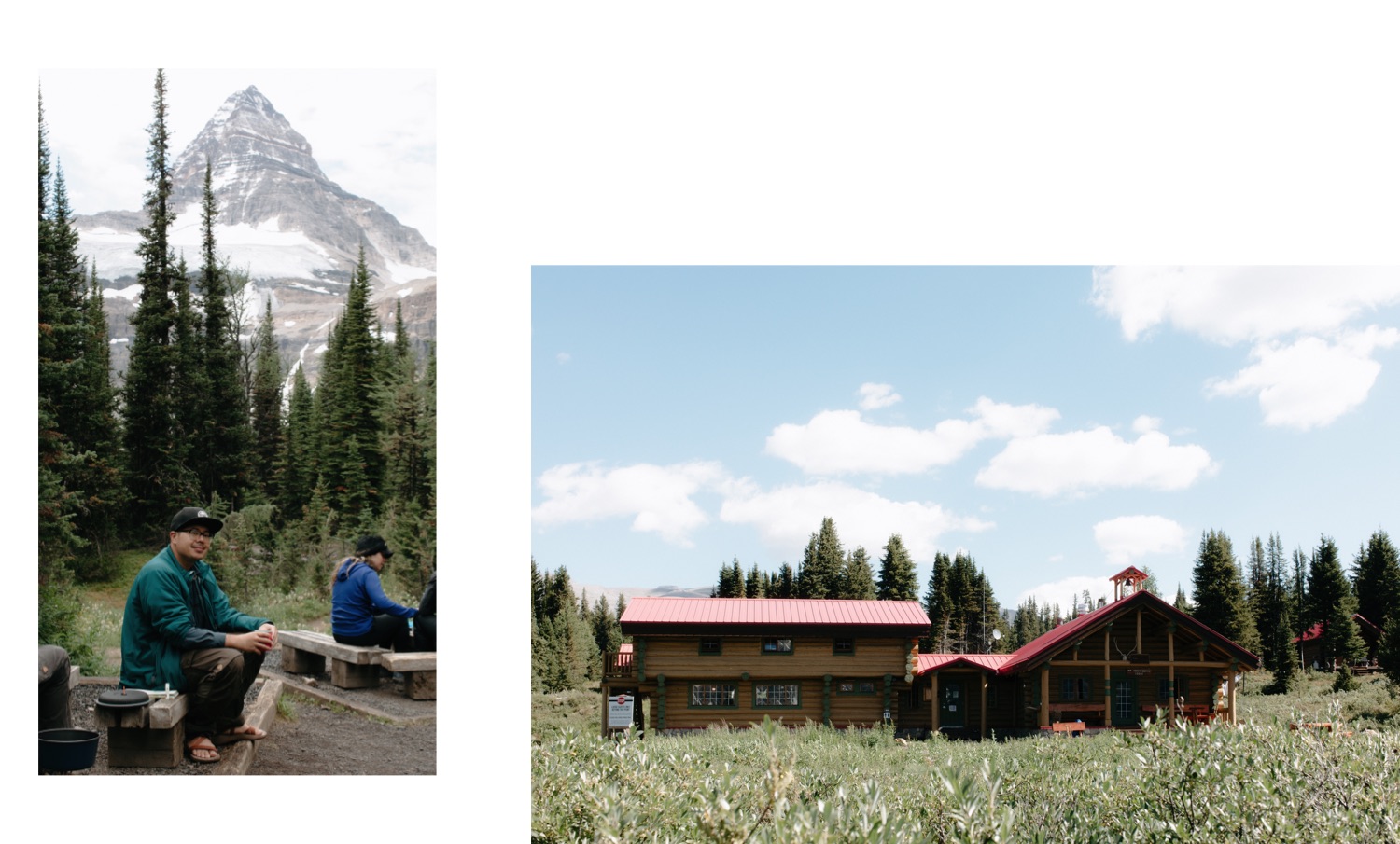
Where to Stay in Mount Assiniboine Provincial Park
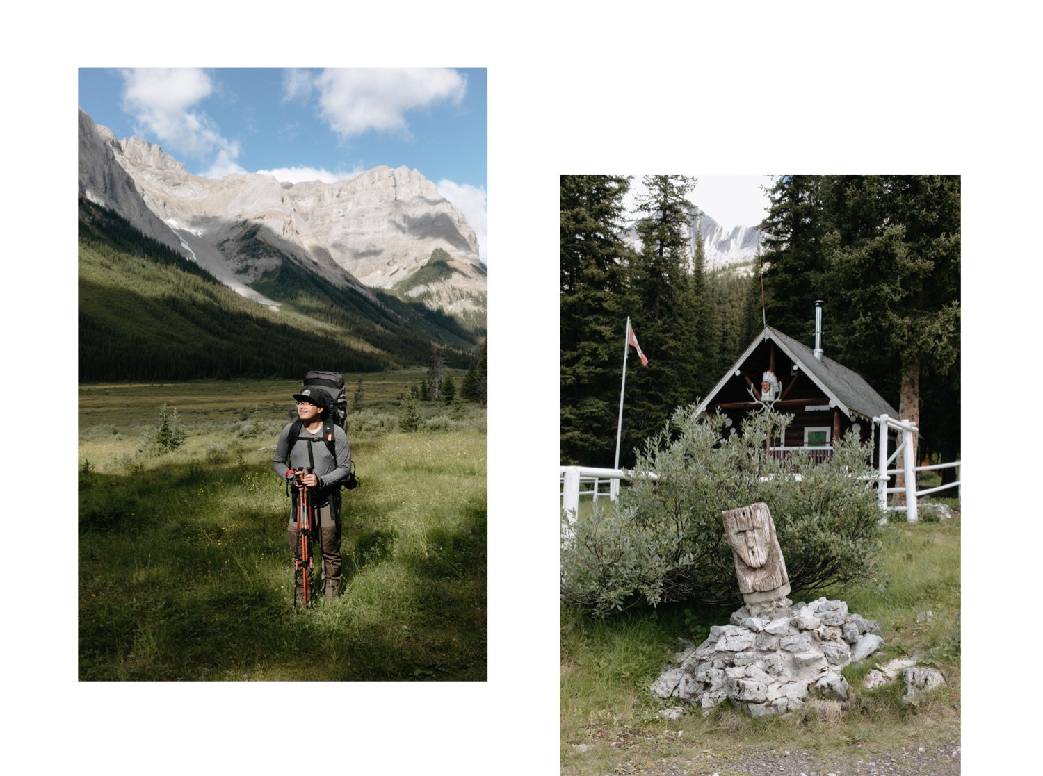
Assiniboine Lodge
The most comfortable of the three options is Assiniboine Lodge. Built in 1928, staying at Assiniboine Lodge affords you warm showers, an actual toilet, and delicious meals. When we visited in the time of COVID, non-lodgers were not permitted in the lodge so I have nothing of personal experience to offer here.
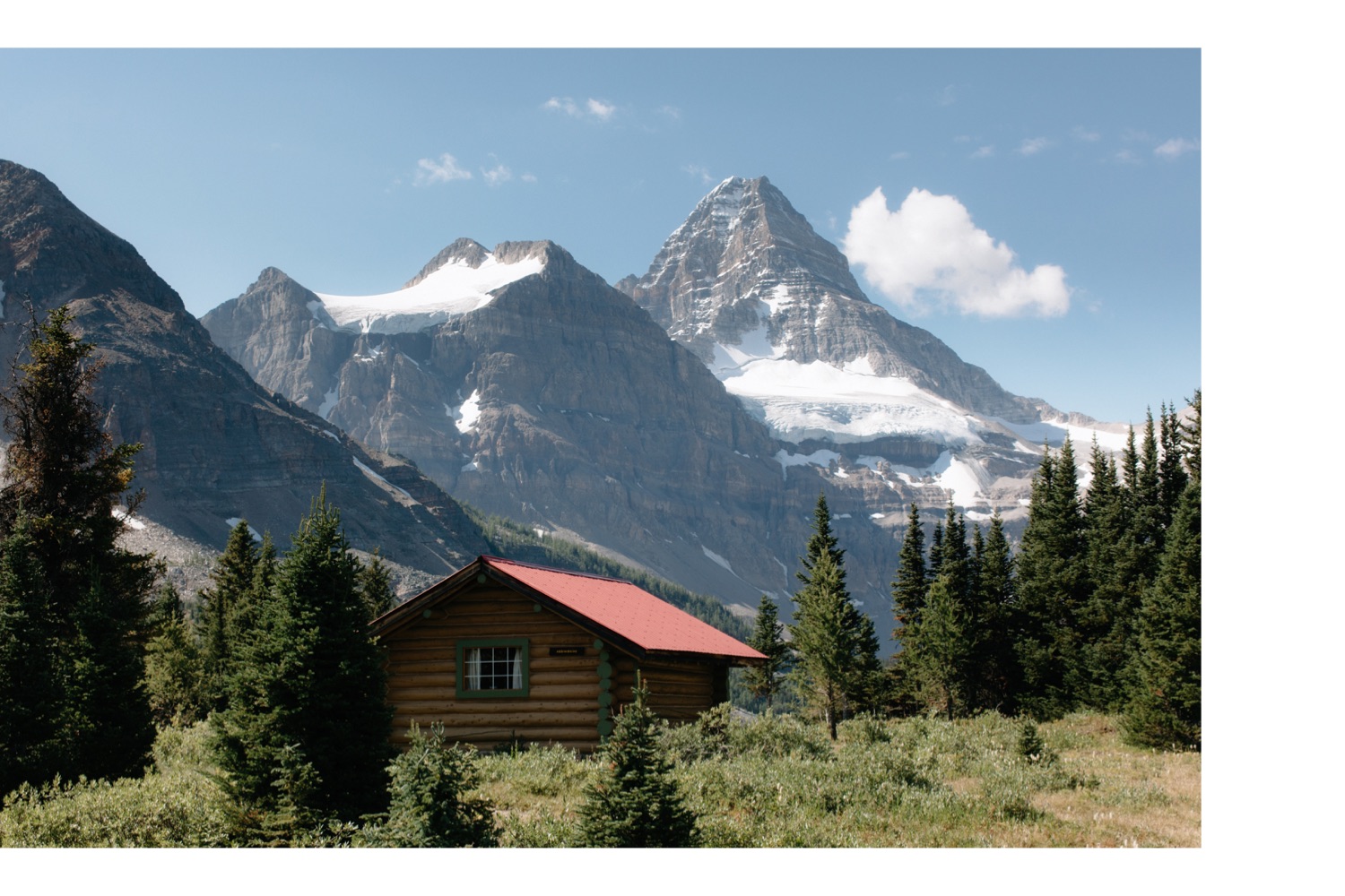
Naiset Huts
The Naiset Huts are also bookable through Assiniboine Lodge, however offer more of a glamping experience with provided foam mattresses, a woodstove, and the Wonder Lodge for cooking and dining. Located at the northeast corner of Lake Magog are several huts built by the Alpine Club of Canada in 1925 and while charming by appearance, can feel a bit cramped especially if you are rooming with strangers.
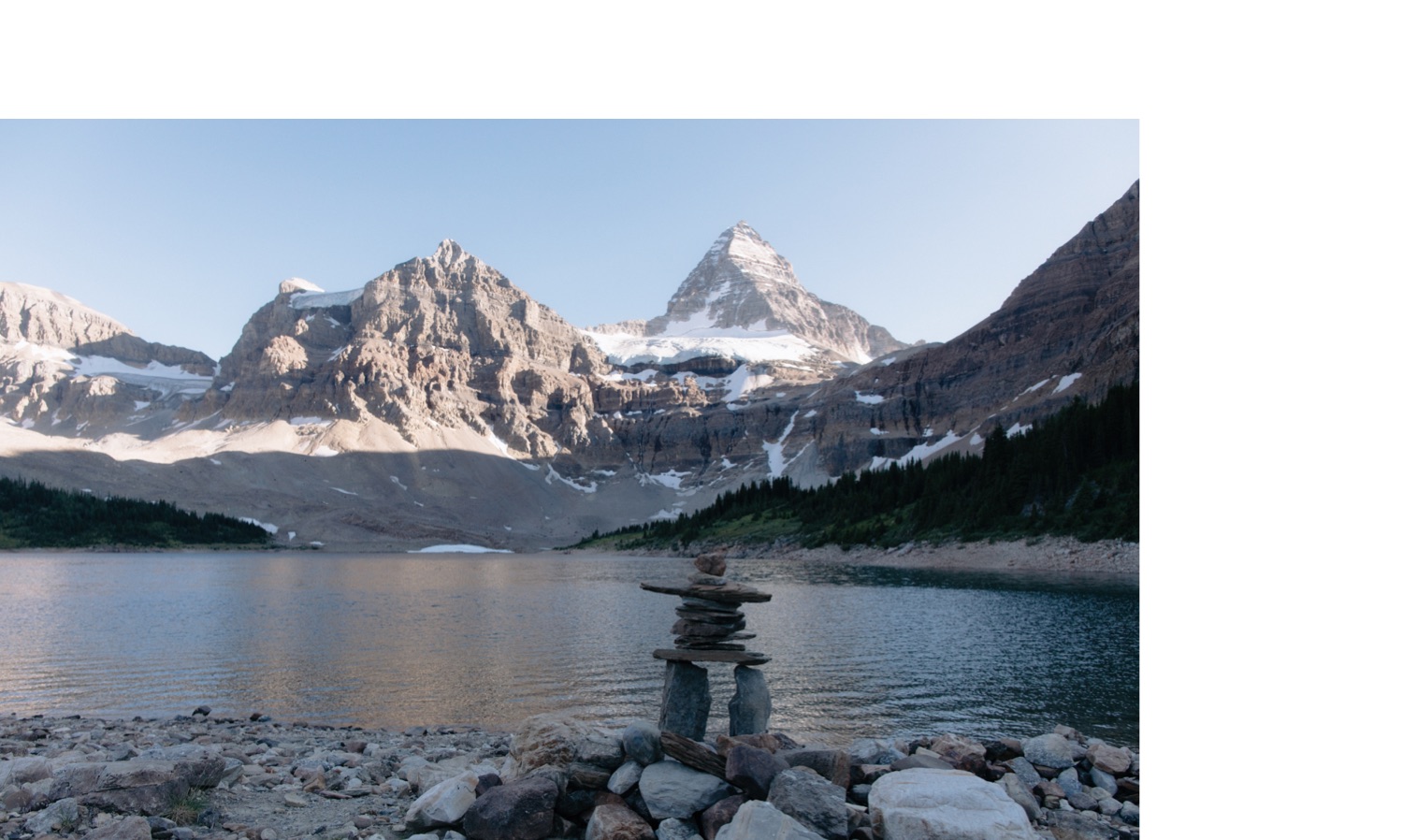
Lake Magog Campground
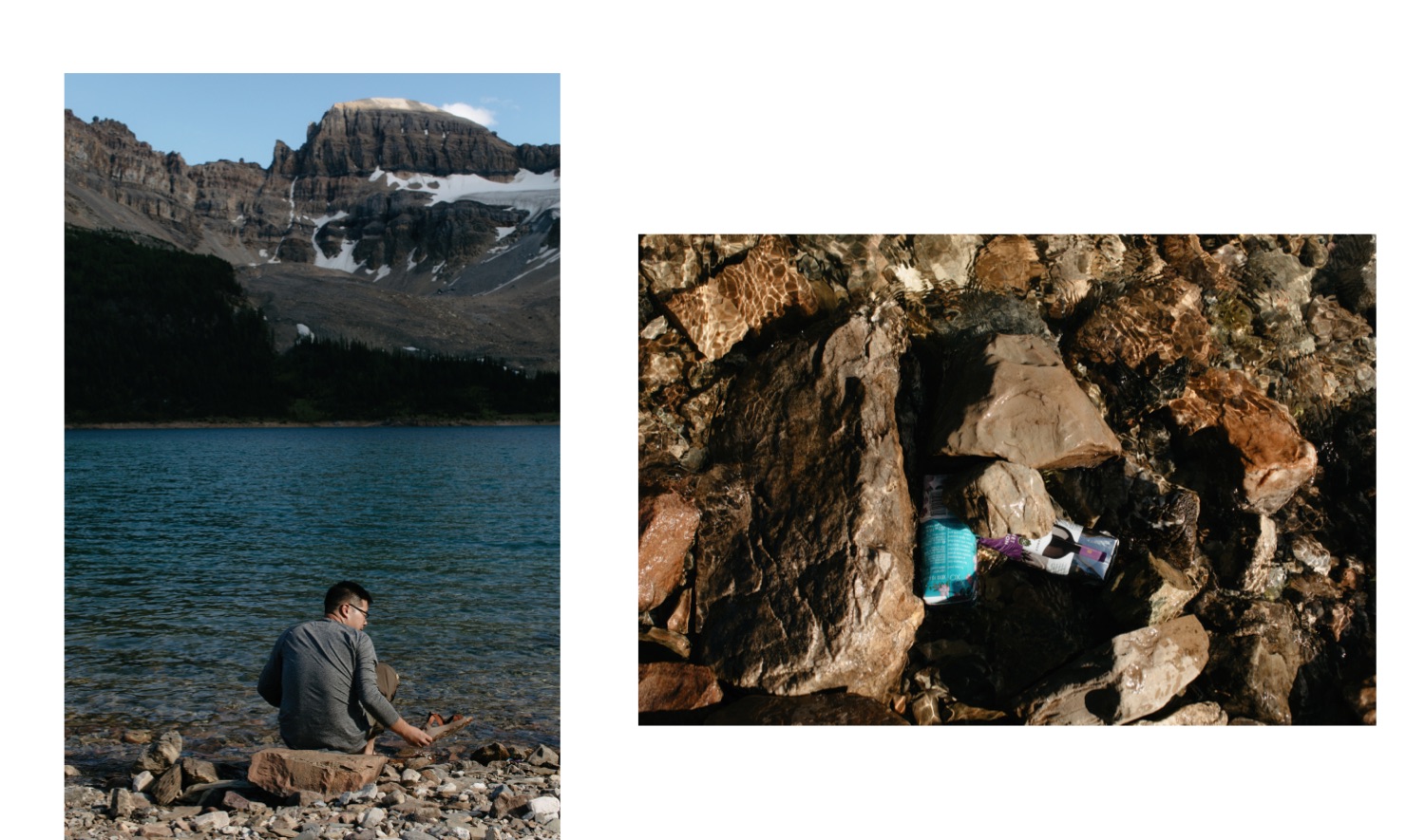
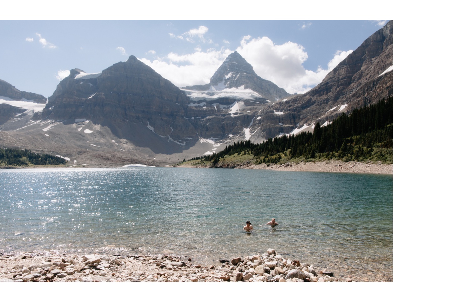
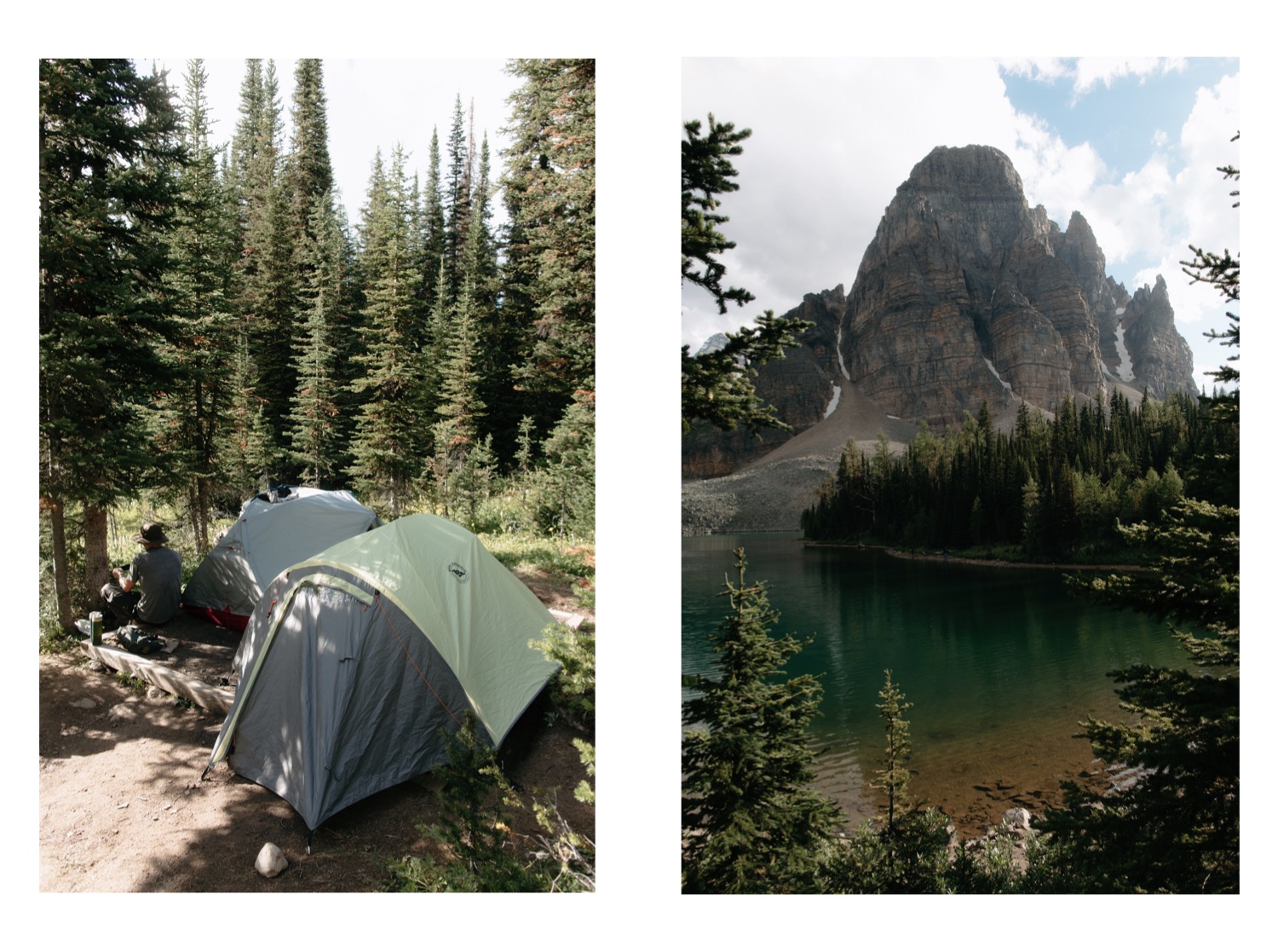
Bookable through BC Parks website, and all the heavy detailed reading about the campground can be found here. Nestled at the back of Lake Magog, away from Assiniboine Lodge and the Naiset Huts, is a campground with relatively spaced out campsites, three eating areas, including one covered dining area, ample food storage lockers, outhouses (which were very clean and had toilet paper), and a secluded rocky beach to watch the sunset or go for a midday swim.
Two tents were allowed per pad, which is what we opted for. Both of our tents were three-person, which meant some interesting set up to fit properly on the pad, but it was doable as long as you aren’t self-conscious of waking your pad neighbour in the middle of the night by turning over.
While reservations are required, the pad itself was first come first serve. I’d recommend especially on hot summer days insuring you have ample tree cover so you don’t return to a sauna.
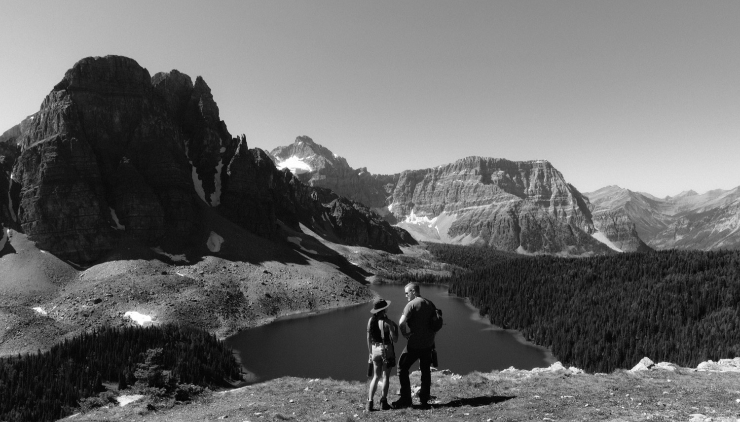
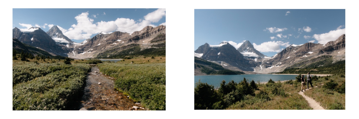
Day Hikes from Lake Magog Campground
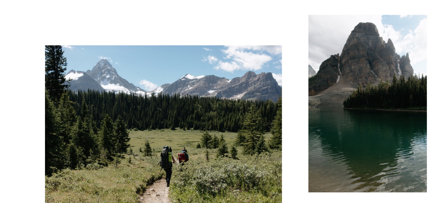
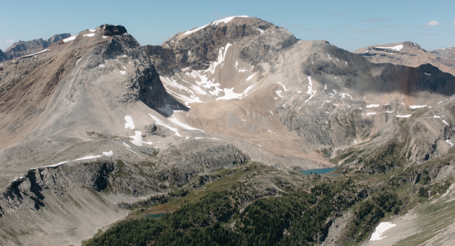
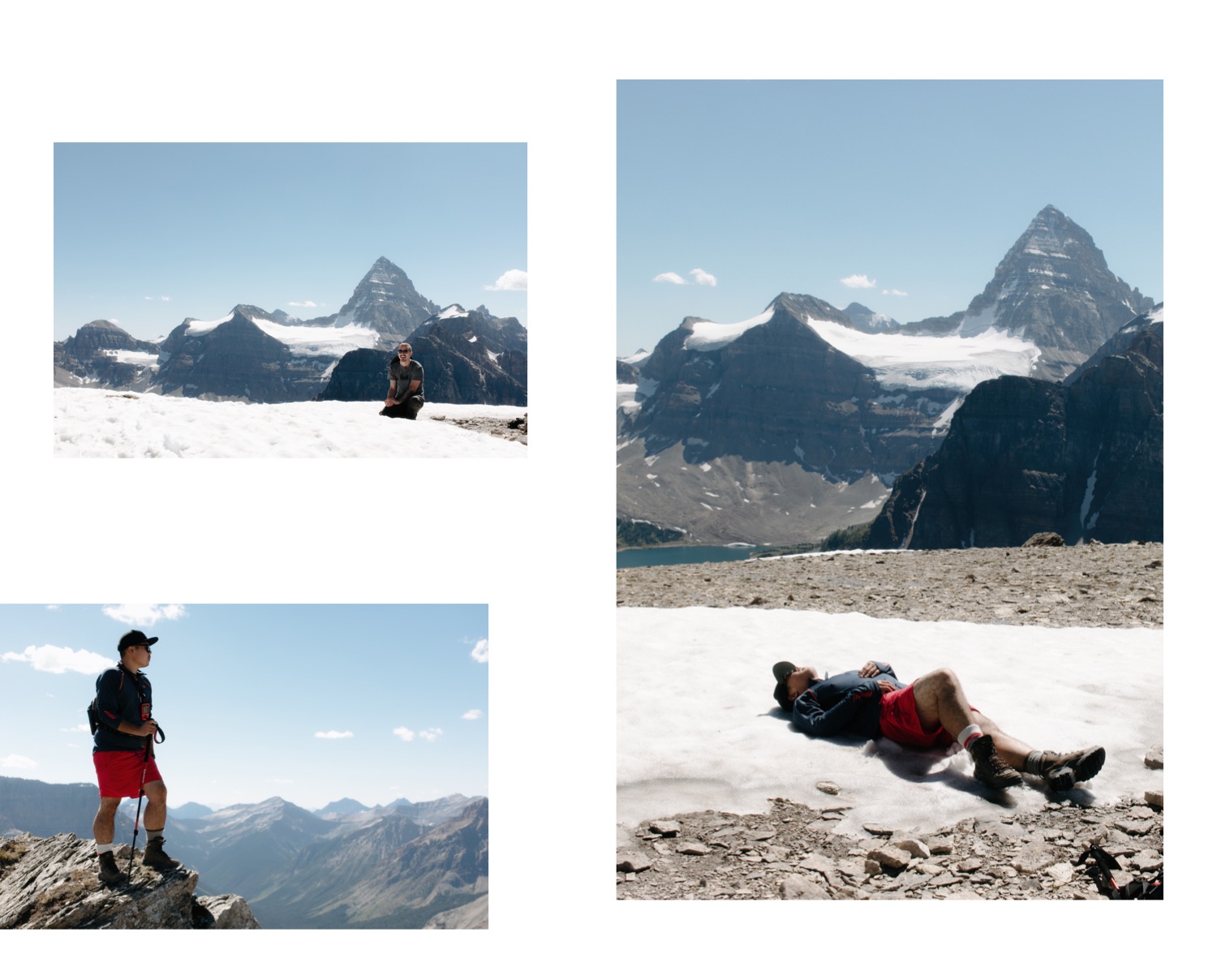
I’ll defer to my top resource Don’t Waste Your Time in the Canadian Rockies: The Opinionated Hiking Guide by Kathy and Craig Copeland for day hikes in Mount Assiniboine Provincial Park. They have recommended itineraries for five day, four day and three day trips. We originally planned to do both Windy Pass, a 15km and 460m day hike, as well as Nub Peak via Sunburst and Cerulean Lakes, a 10.6km trip with 568m elevation. However, on account of the heat, we ended up doing Nub Peak on day two, and explored the meadows, Sunburst and Cerulean lakes and returned to the Niblet on day three instead. So this will solely be about Nub Peak and I hope to add more on my eventual return.
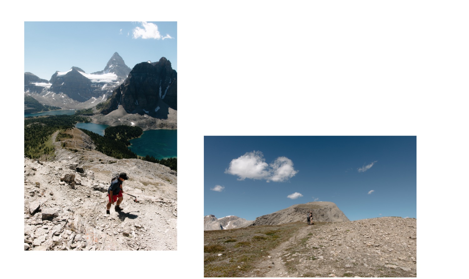
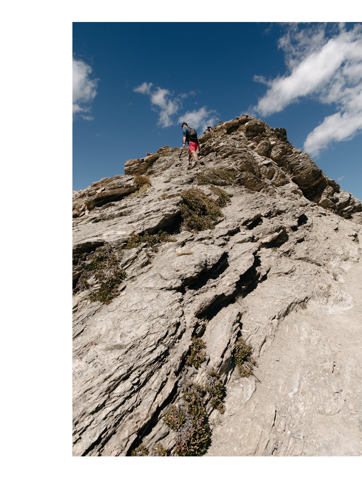
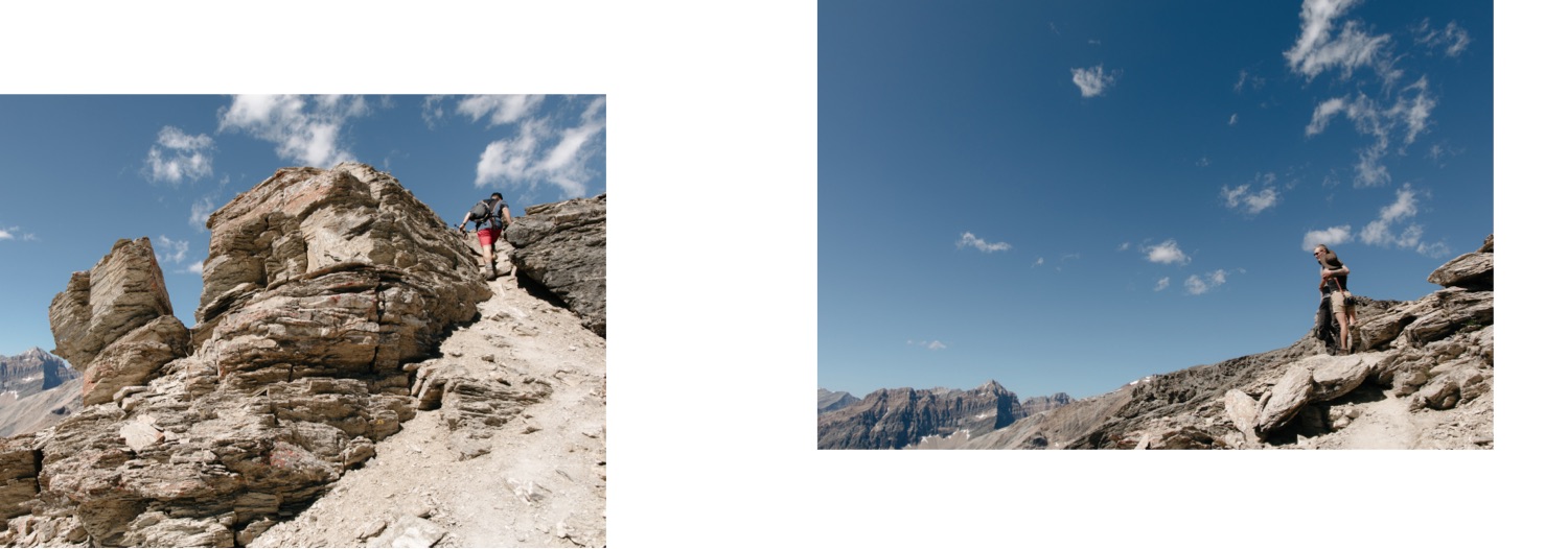
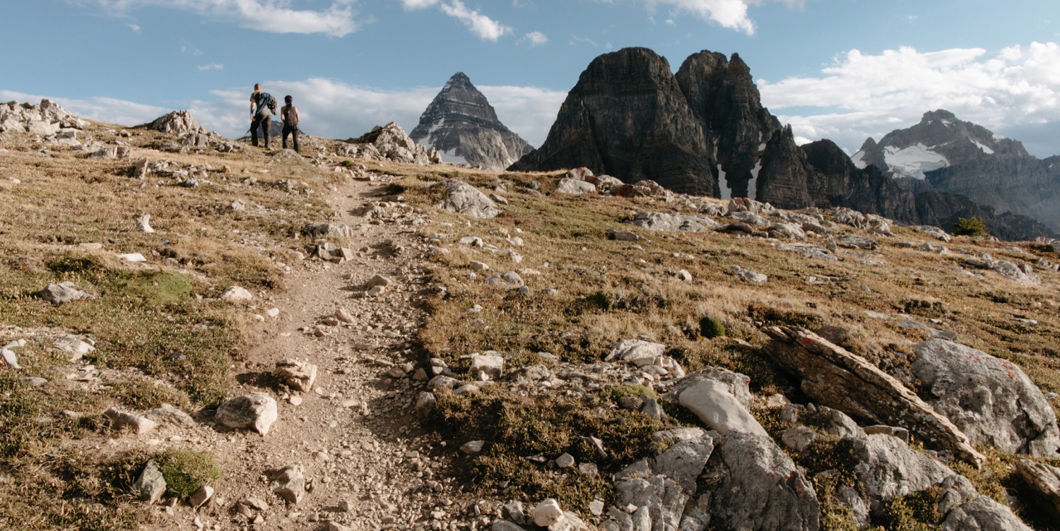
Nub Peak
Accessible from two different routes, one from Lake Magog Campground via Sunburst and Cerulean Lakes, and the second from the Naiset Huts and/or Assiniboine Lodge. We ventured up to Nub peak from the campground, returning that direction on our first hike. The second time we returned to the Niblet for sunset, we returned the Assiniboine Lodge route, which took us through the meadows and alongside Lake Magog.
Our total trip to Nub Peak from and to Lake Magog Campground was 12km, with 700m of elevation gain, including a venture to the Niblet outlook. You may download our GPX route to Nub Peak here.
It’s pretty straightforward save for two spots. The first is at approximately 3km from camp, where you reach a non-marked junction (which is shocking because you’ll become heavily reliant on the little trial markers smattered all about Mount Assiniboine Provincial Park) where straight leads you to Elizabeth Lake and towards Ferro Pass, and a right takes you up switchbacks towards the Niblet. You want to go right.
The second questionable navigation is after the saddle that leads from the Nublet to Nub Peak. Somewhere the trail forks, one leading right and upwards, the other continues left around the rock – both appeared well travelled. Previous readings on a group warned us that the right was the scrambling route and the left the hikers, we stayed left.
Otherwise, Nub Peak is a relatively easy day hike. If you are afraid of heights, or not steady on your feet, you may want to only hike to the Nublet to avoid the most exposed sections beyond the saddle.
What to Pack for Camping at Assiniboine
I am someone who tends to err on the ‘worst-case scenario’ side of packing and want to make sure I am cautiously ready for everything. Pretty much my nightmare is being one of those safety posts where it ends with ‘if they had been better prepared, the outcome may have been different’. So if that doesn’t resonate with you, this may not be the guide to follow.
When preparing to backpack to Assiniboine, I looked over many packing backpacking lists and ultimately determined the REI checklist was the most thorough, well organized, and helpful. From their checklist, all I didn’t bring were fleece pants, as I had a couple thermal pants instead which were lighter and less bulky, gaiters, as the weather was calling for little to no rain and the trail is well defined, and most of the items under Backpacking Extras.
Overall, our packing was damn near perfect in retrospect. But I want to go over the few items we did not end up using, items we wish we had brought, and lastly, the real star items from the backpack.
Items We Didn’t Use
Toilet Paper
Turns out the Lake Magog campground provided toilet paper in the outhouses so the roll we brought went quite unused. That said, I would bring the entire roll again in case things changed as well as for any trail episodes where it is needed.
Rain Layers
This goes for our rain jackets as well as our backpack rain covers. The rain jackets were amongst the bulkiest items in our packs however I still would not venture into the backcountry without them despite a clear forecast because, well, it’s the mountains and you never know. Also, it can snow in any month at Mount Assiniboine Provincial Park, so we were preparing for these layers to also protect against any rogue snowstorms.
First Aid
Save for perhaps one pack of moleskin our First Aid kit went entirely untouched and I cannot be any more delighted about that.
Items We Wish We Brought
More Bug Spray
I’m one that prefers to stay on the more natural side of products, but hear me out, you need the strongest fricking bug spray for this trip. Whether it be mosquitos on the way in (tolerable), or the black flies at the dining areas (intolerable), you’ll be thankful for your bug spray (with all the DEET). We also lusted after the mesh hats some fellow campers were enlightened enough to bring. Long sleeve shirts help, but those buggers managed to bite through thinner layers and one midday sent us in search of reprieve on Sunburst Lake which had the perfect combination of light wind and sun to keep them at bay. Seriously, we were not prepared for the onslaught of bugs. Learn from us.
Gravity Water Filter
Camping is a bit of a throwback to days before electricity and as I filtered water in camp, I felt a deeper understanding of my ancestors before me who had to do laundry by hand (no thank you). Mundane, yet crucial work. Unfortunately, my gravity bag did not arrive in time so I had to squeeze all our water by hand through our Sawyer Mini filter, but oh how I would have loved to have a gravity water filter. Also, love our Sawyer Mini filter, hate the squeeze bags which have a tendency to burst – so if you get one, make sure you have backups.
Most Coveted Items for Backcountry Camping
Snacks
This goes first because after safety, let’s all admit snacks are the most important thing in your bag (this is sarcasm, kind of).
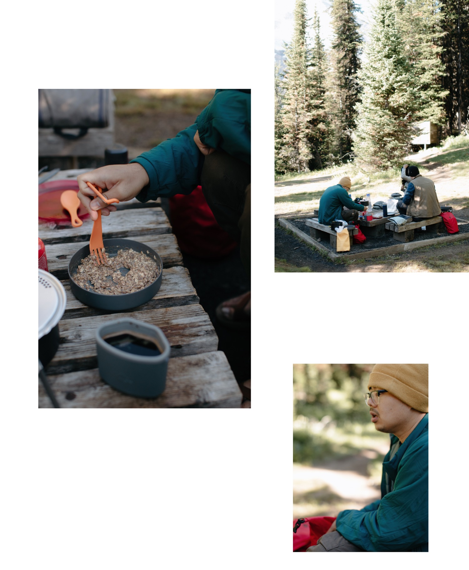
Let’s start with touching on camp meals, we decided to uncomplicate things a bit and rather than make our own camp meals relied on prepackaged dry meals. You do you, but trust me the vegetarian options always outperformed any meal with meat.
The real MVP of this trip is Peanut M&Ms. Literally the ideal camping snack. They don’t melt, they have chocolate, they pack a caloric punch with the peanut (and I mean the chocolate). I would like to thank our friend Buffy for introducing us to the wonderfulness that is Peanut M&Ms in the backcountry.
The close second MVP was the boxed wine that Sam insisted we bring despite me being all on my ‘but necessary weight only!’ high horse. After setting up camp and heading down to Lake Magog to soak our feet, we tossed the boxed wine in the lake and anchored them with a rock. Ten minutes later we enjoyed our chilled wine as we gleefully looked back on a day of personal accomplishment and it could not have been any better way to end our first day. Our friends brought wine in a bladder.
Dried seaweed was also a delectable snack. Lightweight, satisfying, salty, easy cleanup. Do recommend.
Lastly is beef jerky – I’m not talking about the typical store variety. We bought beef jerky from Red Gables Deli in Canmore for a quick pick me up on the trail and we rationed like our lives depended on it, becuase it’s damn good.
Detachable Day Packs
When buying a multiday backpacking pack I’d recommend prioritizing one that has a detachable day pack. The brain of our packs easily unattached to become the dorkiest sling fanny packs, and we could not have been more grateful for our day hikes.
Hydration Tablets
Credit goes to Camille and Justin for having the foresight to bring electrolyte tabs, because Sam and I did not. After a long day of hiking, it was refreshing and zhuzhed up a basic litre of water.
GPS Watch and Communication Device
As I stated previously, I am on the more cautious side of things. So despite having my Garmin Fenix 3 watch for basic navigation and data collection, I opted to also purchase a refurbished Garmin InReach Explorer+ device for this trip. There are rental options available, however, the cost, when compared to refurbished, made the splurge worth it. Not wanting to spend extra money on a watch? I was impressed with how well Strava tracked the hike on Camille’s phone, and my friend Terence who also hiked to Assiniboine earlier in the summer recommended the Gaia app for tracking distance and elevation.
From August 15-18, we walked a total of 93.7km and gained 2247m of elevation. I find this fascinating and consider it such an accomplishment. The communication device allowed for our family members to track our hike in and out of Assiniboine, as well as have the ability to contact us in an emergency situation. With my father’s health being a bit precarious, this calmed my anxiety. Are such devices necessary? No. Are they handy when your group of four can’t remember who sang Tainted Love and decide that is a worthwhile use of one of your prepaid text messages? Absolutely.
How to Prepare for a Backpacking Trip
So, let’s say you are an enthusiastic front country camper and hiker but have yet to do an extensive multiday backpacking trip in the Canadian Rockies? Well, that was me. So let this be a concise version of all the research I did to confidently backpack to Mount Assiniboine Provincial Park.
- Get your gear properly fitted. In particular, I am talking about your hiking boots and your backpack. You need to know where those hot spots are and how to prevent them, what socks work best (Sam had to wear different types of socks on each foot), and how to properly troubleshoot any indications of pain from your boots or pack. In a non-COVID world, I’d recommend seeing a professional in-store who can properly fit your boots and backpack. But in a COVID world where we accidentally inherited nearly decade-old packs without the option to be fitted, we used this video from REI on how to properly fit our packs.
- Learn how to pack your gear. I’m confident I spent nearly a full day scouring the internet for backpacking gear lists and how to pack my bag. I found the REI backpacking gear list the most extensive and useful. For packing the most useful was a video from a fellow I’m quite confident spends 98% of the year off the grid and I cannot for the life of me find that video. So in the meantime, this article extensively goes over things to keep in mind when packing your bag, from weight distribution to where to pack specific items.
- Do both hiking test runs as well as overnight camping trips. I’m grateful for the two months advance booking because it left me 60 days to get into shape and prepared. After buying new boots, and acquiring new packs, we first went on a couple of easy out and back hikes in the Banff area, with our bags packed as we would for Assiniboine. I’d recommend Boom Lake, which is an 11km out and back trail with minimal elevation gain trail between the Banff townsite and Lake Louise. On these little day hikes I learnt I had a tendency to tighten my hip pads far too much which caused bruising. For easy overnight backcountry trips in the Banff area we did both Elbow Lake Backcountry Campsite in Peter Lougheed Provincial Park at an easy (yet surprisingly steepish) 1.3km with 125m of elevation gain. The month before we scored a couple of nights at Laughing Falls Backcountry Campground in Yoho National Park 4.4km one way with 125m of elevation gain. On these test runs of backcountry camping, we grew more confident in our gear, as well as discovered more weight should be allocated to snacks.
- Learn about leave no trace principles. I’m sure as a lover of the outdoors you are familiar with packing out what you packed in, how to dispose of waste properly, and how to respect nature and wildlife, but if you need a refresher, you may find one here.
- Leave a detailed plan with someone. Likewise, I am sure you are already in the habit of informing a family or friend when you are heading out on a trail, but in case you need a reminder. For Assiniboine, I created a Google document that included each of our family member’s contacts, an overview of our routes, projected start and finish time, and what to do if we hadn’t been heard from by a certain time.
Dogs and Mount Assiniboine Provincial Park
I’m not saying dogs are allowed in Mount Assiniboine Provincial Park. All I’m saying is that from all my reading as of August 15, 2020, I could not find any literature that stated dogs were not permitted in Mount Assiniboine Provincial Park. So if you are considering bringing your dog, read the current literature, double-check the campground booking, call the warden, don’t read this as permission.
Our 7-year-old dog, Hobbit, is a keen hiker and has joined us on nearly every trip over the past five years. When we booked our Assiniboine trip in June, we were considering bringing her, however ultimately decided three weeks beforehand she’d be best left at home. Between a small leg injury at the end of June, coupled with her age, the possibility of quite hot weather in the middle of August, the total distance, and an increased risk of bear encounters in this part of the Canadian Rockies, we decided it wasn’t worth the risk. If we had brought her, a good part of our packs would be used for her food, sleeping bag, overnight jacket, a cooling vest, and an emergency dog carrying harness.
We felt confident in our decision following our trip, she had a grand time staying at home with a friend of ours. Plus, she joined us on all our other backcountry camping trips that summer. So, hoping to bring your dog friend? I’d recommend considering the worst-case scenario, if your dog is not able to hike, would you and your group be capable of carrying them if need be?
Recommended Resources for Backpacking to Mount Assiniboine
Don’t Waste Your Time in the Canadian Rockies: The Opinionated Hiking Guide by Kathy and Craig Copeland
BC Parks website on Mount Assiniboine Provincial Park
Planning a wedding or elopement at Mount Assiniboine Provincial Park? I would absolutely love to be in touch. Whether it be flying in by helicopter, or making a multiday backpacking trip of it, I would love to be a part of it.
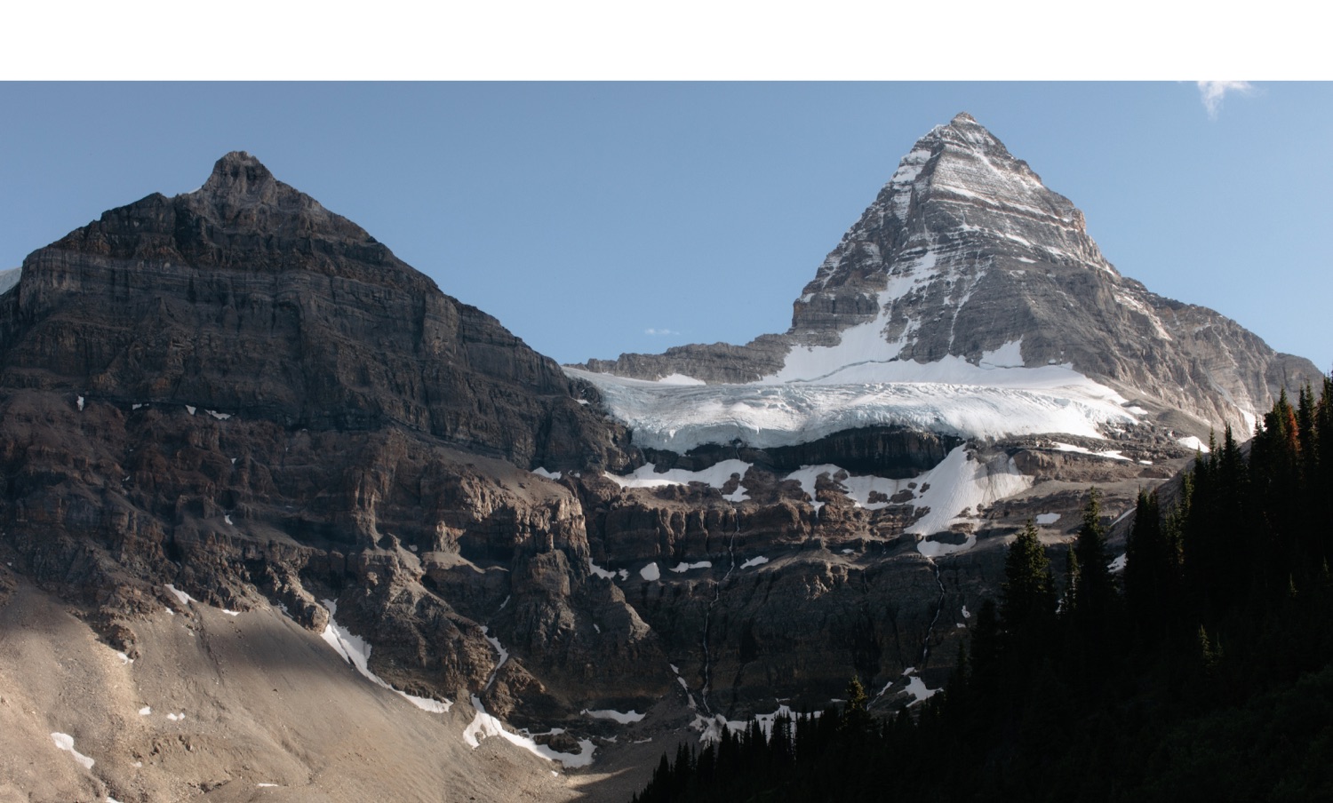

What a journey. Just incredible. I first saw photos of the region a few years back on a ‘photography tour’ and I have wanted to visit ever since. I hope to at one point in my life and to capture the light and the mountains from dawn to dusk (and the stars).
Thanks for sharing such a detailed trip, looked awesome!